
On this page
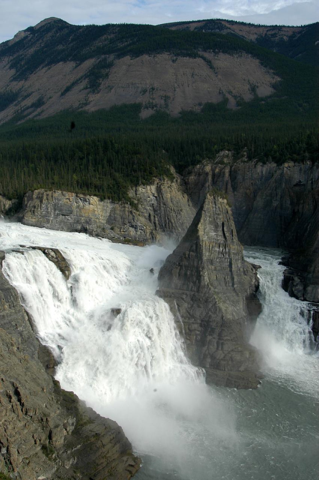
The Northwest Territories run on scale: a waterfall twice Niagara's height that most Canadians have never seen, bison on the highway shoulder, and some of the most reliable aurora on Earth. The road network is small and honest, and Yellowknife makes an easy, strange, likeable base.
Roads, ferries and ice
- The territorial highway conditions page is the source of record, and it matters more here than anywhere: several highways depend on ferries in summer and ice bridges in winter, with shoulder-season gaps when neither runs.
- Yellowknife connects south via Highway 3 around Great Slave Lake; the Deh Cho route makes a grand loop with Alberta and BC.
- The Inuvik to Tuktoyaktuk highway finished the continent's road network in 2017. You can now drive to the Arctic Ocean and dip a toe in it.
- Wood bison walk the highways near Fort Providence and the Liard. They have right of way by mass and precedent.
- Fuel discipline is the first law: fill at every opportunity, carry a jerry can on remote legs, and download maps before leaving town.
What it costs
| Cost | Typical | Notes |
|---|---|---|
| Sales tax | 5% | GST only, but Yellowknife adds a 4 percent hotel levy |
| Territorial campsite | $25 to $40 a night | NWT Parks, reservable online, comfortable for the latitude |
| Highway ferries | Free | Operated by the territory; ice crossings are free too |
| Aurora viewing tour | Roughly $150 to $250 a night | Heated lodges and teepees; three nights buys good odds |
| Nahanni day flight | Well over $1,000 per person | Floatplane from Fort Simpson or Yellowknife, and worth it |
| Groceries and fuel | Well above southern prices | Higher again off the main highways |
Checked August 2026. Operators and NWT Parks publish current rates.
Wildfire and camping
The territory posts wildfire updates with fire danger and any bans. Bad seasons close highways and blanket weeks in smoke, so that page belongs next to the road report in a northern summer. NWT Parks runs a surprisingly comfortable campground network along the highways, reservable online, busiest around Yellowknife and the waterfall route in July. Wild camping on public land is generally accepted for the self-sufficient. Nahanni is different: fly-in, permit-based through Parks Canada, and most visitors go with licensed operators.
Rules and practicalities
| Category | In the Northwest Territories |
|---|---|
| Time zone | Mountain, with daylight saving |
| Top speed limit | 100 km/h on Highway 3, 90 on most others, less on gravel |
| Alcohol | 19. Government stores, and several communities restrict or prohibit it entirely |
| Cannabis | 19. Sold through liquor stores and online |
| Ferries and ice roads | Free, but they stop during freeze-up and break-up. Check before committing to dates |
| Bison | Wood bison on the highway are common and enormous. Slow right down and wait |
| Emergency | 911 works territory-wide, which has only been true since 2019 |
| Connectivity | Coverage is community-and-highway only. Satellite messengers are standard kit here |
When to go
| Season | Best for | Watch for |
|---|---|---|
| Late August to early October | Aurora with open water and mild nights, fall colour on the tundra | Services wind down, first snow |
| June to August | Midnight sun, paddling, the waterfall route, Nahanni season | Mosquitoes, wildfire smoke and closures |
| Mid November to mid April | Deep-winter aurora, ice roads, dog sledding | Minus 35 is normal, ferries replaced by ice crossings |
| April to May and late October | Very quiet and cheap | Freeze-up and break-up strand some highways for weeks |
The stops worth planning around
- Yellowknife: Old Town houseboats, bush planes, the Bush Pilot's Monument view, and aurora infrastructure without equal.
- Nahanni and Virginia Falls: the day flightseeing from Fort Simpson or Yellowknife is expensive and remembered forever.
- The waterfall route: Alexandra and Louise Falls on the Hay River corridor make the southern approach a destination.
- Wood Buffalo: the world's largest dark sky preserve, whooping crane nesting grounds, and salt plains you walk barefoot.
- Tuktoyaktuk: pingos on the horizon and the Arctic Ocean at the end of the road.
- Great Slave Lake's East Arm: Thaidene Nëné's cliffs and clear water, the fly-in or boat-in reward.
Location: Yellowknife, Great Slave Lake
Location: Tuktoyaktuk, Arctic Ocean
The official pages
- NWT highway conditions Roads, ferry status and ice crossings. https://www.inf.gov.nt.ca/en/services/highway-conditions-map-drivenwt
- NWT wildfire update Fire danger, bans and smoke conditions. https://www.gov.nt.ca/ecc/en/services/wildfire-update
- NWT Parks camping Territorial campground reservations. https://www.nwtparks.ca
- Spectacular NWT The territorial tourism site. https://spectacularnwt.com
Common questions
- When is the best time to see the aurora in Yellowknife?
- Two windows: late August to early October, when lakes are open and nights are mild, and mid November to mid April, the deep-winter season of long dark nights. Yellowknife sits under the auroral oval with famously clear skies, so visitors who stay three or more nights get excellent odds in either window.
- Can you drive to the Arctic Ocean in Canada?
- Yes. The all-season Inuvik to Tuktoyaktuk highway opened in 2017, connecting the Dempster Highway to the Arctic coast. It is gravel, weather-dependent and remote, and it ends at a hamlet on the Beaufort Sea where the traditional finish is wading in regardless of temperature.
- How do you get to Virginia Falls in Nahanni?
- Only by air or river. Most visitors take a floatplane day trip from Fort Simpson, landing above the falls for a guided walk to the brink, while the immersive version is a one-to-three-week guided paddle down the South Nahanni. All visits register through Parks Canada, and there is no road access at all.
- Do the NWT highway ferries cost anything?
- No. The territory operates its highway ferries free of charge, and the winter ice crossings that replace them are free too. The catch is timing rather than money: during freeze-up in late autumn and break-up in spring, neither the ferry nor the ice road runs, and some communities are cut off for weeks.
Tip
Ferries and ice bridges mean the NWT has genuine no-go weeks in spring and autumn on some routes. Checking the conditions page before committing to dates is the whole trick.